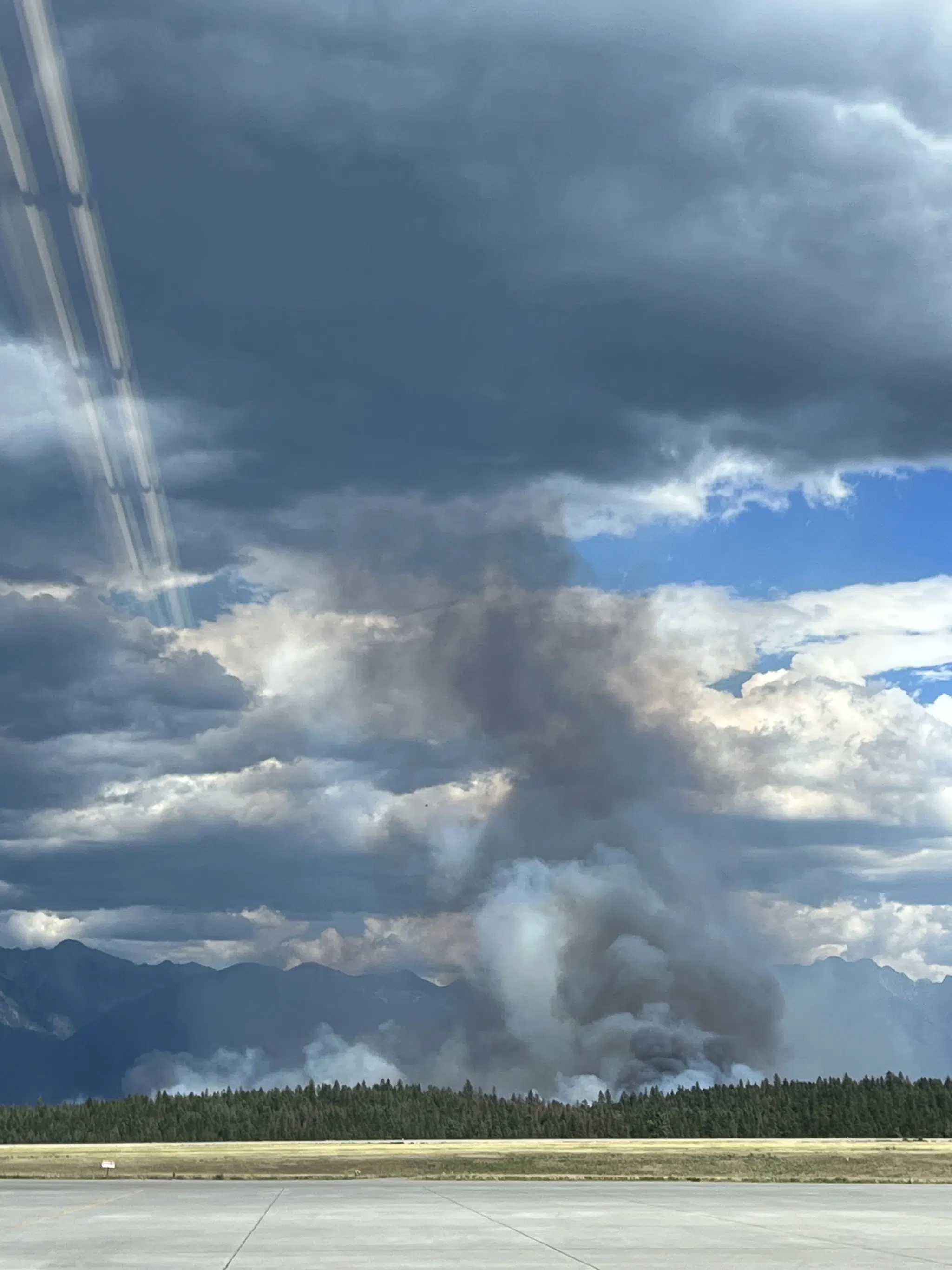
Updated mapping measures St. Mary’s River Wildfire at 2,601 hectares

Thursday afternoon’s update from the BC Wildfire Service confirms earlier reports from the firefighting agency that the St. Mary’s River Wildfire has experienced growth to the north.
Updated mapping from the provincial wildfire agency pegs the blaze near ʔaq’am at 2,601 hectares, this following a response officer flying over the blaze Thursday to obtain an accurate track of the fire.
They say the majority of the fire’s growth was to the north and was experienced during Wednesday’s peak burning period, this was followed by reduced fire activity early Thursday due to cooler temperatures and increased humidity.
Conditions on Thursday allowed crews to conduct hand ignitions with aims of structure protection, they’re reporting no major fire activity or growth was noted in the Bummers Flats area west of the Kootenay River through the day, crews are establishing a wetline starting from the St. Mary’s River.
The wildfire continues to be actioned by 125 BC Wildfire Service members, local fire departments, heavy equipment and aerial support.
The community of ʔaq’am has upgraded one property to an Evacuation Order at 8425 LD Ranch Road. The community’s Evacuation Order covers 52 properties while 9 are on Evacuation Alert. An additional 33 properties remain on Evacuation Alert via the Regional District of East Kootenay.
Find more information on the community of ʔaq’am’s updated Evacuation Order below:
Please see this additional order. Presently there are 52 Evacuation Orders and 9 people on alert.
Posted by ʔaq̓am Community – St. Mary's Indian Band on Thursday, July 20, 2023
Find more information from the BC Wildfire Service below:
Wildfire Information
Fire Behaviour & Site conditions
Winds subsided in the early morning hours on Thursday. Lower temperatures and increased humidity have significantly reduced fire activity. Rank 1 and 2 fire behaviour (generally smouldering or low vigour surface fire with occasional candling) is observed this morning. Learn more about Wildfire Rank here.
The northeast and northwest corner are expected to be more active later in the day with southwest winds it the forecast.
A response officer was able to fly the fire this afternoon to obtain an accurate track of the fire. The size is now mapped at 2,600 hectares. This growth is a result of the increased fire activity that occurred during the peak burning period on Wednesday, July 20th.
Ground Operations
The majority of the growth was to the north, the majority of the active fire remains east of the upper mission road over to the Kootenay River and around the Francis Lake area south of Francis Lake. There is a pocket of fire that crossed the mission road to the west, which is just north of the Spring prescribed burn. Crews worked through the night pushing control lines with heavy equipment and conducting small-scale ignitions to contain this escape. These ignitions are done to remove fuels in a controlled way. Work in this area is ongoing. No major fire activity or growth was noted in the Bummers Flats area west of the Kootenay River. Crews are establishing a wetline starting from the St. Mary’s river.
Site and weather conditions have aligned for ground crews to start a hand ignition this morning to protect residences on the north end of Mission Wasa Low Road. The ignition is estimated to be 50-hectares in size. Planned ignitions are an essential firefighting tactic to remove fuels in a controlled manner and create a higher level of containment. As of 4:15 on Thursday, the planned ignitions are complete, crews are doing mop-up and patrolling. This area will be monitored overnight to monitor the ignition site.
Ground crews, heavy equipment, and aviation resources will be in the area to support this operation.
Aviation
Three heavy-lift helicopters are now assigned to the incident. Helicopters and airtankers including skimmers are going to be working throughout the day reinforcing control lines and supporting any small scale planned ignitions; as long as visibility allows for safe flying. Information on retardant can be found here.
Structure Protection
Structure protection is set up in Cherry creek and structure protection will be on site with split shifts, crews will be monitoring this site during the day and overnight. Structure protection crews are also working on Firesmarting properties in this area to remove flammable materials from around properties.
As a precautionary measure, structure protection assessments and plans are being put in place for any residences that could be impacted by fire growth in the coming days.
Structure defense crews continue to arrive from throughout the province and are being integrated into the incident as they arrive.
Evacuation Orders and Alerts
The ʔaq’am community has implemented an updated evacuation order and expanded the evacuation alert as follows: https://www.facebook.com/aqam.community
The Regional District of East Kootenay has implemented an evacuation order and expanded the evacuation alert as follows:
https://www.rdek.bc.ca/departments/protectiveservices/emergencyinfo/evacuation_alerts_orders/
Donations
No approved GoFundMe campaigns have been started by the ʔaq̓am staff in response to this wildfire. Any GoFundMe campaigns linked to this incident are not connected to the community. Further details can be found in the official media release.
– Article includes files from BC Wildfire Service and community of ʔaq’am

