East Kootenay wildfire update: Thursday, August 10, 2023
![](https://media.socastsrm.com/wordpress/wp-content/blogs.dir/2924/files//2023/07/lladnar-creek-wildfire-near-sparwood.png)
Aug 10, 2023 | 4:23 PM
Wylie Henderson
The BC Wildfire Service is tending to several active wildfires in the East Kootenay.
View more information from the BC Wildfire Service via the Regional District of East Kootenay below:
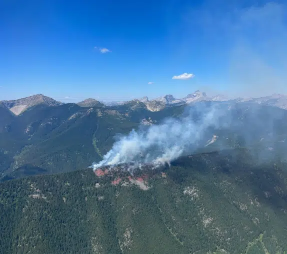
UPDATE from BC Wildfire Service (4:04pm Aug 10)N12046 Lladnar Creek Wildfire – 1.5km W of Sparwood
945ha (mapped)
…
Posted by Regional District of East Kootenay (RDEK) on Thursday, August 10, 2023
UPDATE from BC Wildfire Service (4:04pm Aug 10)
N12046 Lladnar Creek Wildfire – 1.5km W of Sparwood
![▪](https://static.xx.fbcdn.net/images/emoji.php/v9/t4c/1/16/25aa.png)
N11805 St. Mary’s River (ʔaq̓am)
![▪](https://static.xx.fbcdn.net/images/emoji.php/v9/t4c/1/16/25aa.png)
N22370 Jubilee Mountain – approx 9km NW of Spillimacheen
![▪](https://static.xx.fbcdn.net/images/emoji.php/v9/t4c/1/16/25aa.png)
N71918 Kamma Creek – approx 27km W of Moyie
![▪](https://static.xx.fbcdn.net/images/emoji.php/v9/t4c/1/16/25aa.png)
N12352 Lum Creek – NE of Fisher Peak
![▪](https://static.xx.fbcdn.net/images/emoji.php/v9/t4c/1/16/25aa.png)
N22240 Mia Creek – approx 17km NE of Canal Flats
![▪](https://static.xx.fbcdn.net/images/emoji.php/v9/t4c/1/16/25aa.png)
N22243 Horsethief Creek – approx 10km W of Invermere
![▪](https://static.xx.fbcdn.net/images/emoji.php/v9/t4c/1/16/25aa.png)
N21453 Yearling Creek – approx 23km E of Radium Hot Springs
![▪](https://static.xx.fbcdn.net/images/emoji.php/v9/t4c/1/16/25aa.png)
– Article includes information from BC Wildfire Service/Regional District of East Kootenay
![](https://cdn.worldweatheronline.com/images/wsymbols01_png_64/wsymbol_0002_sunny_intervals.png)
East Kootenay, BC, Canada
-9 °C Partly cloudy